
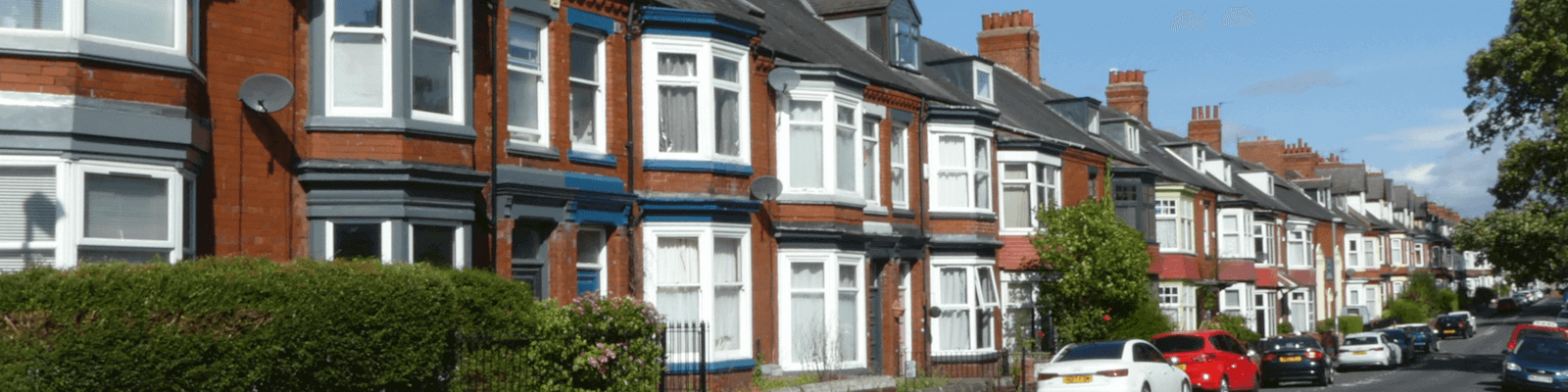
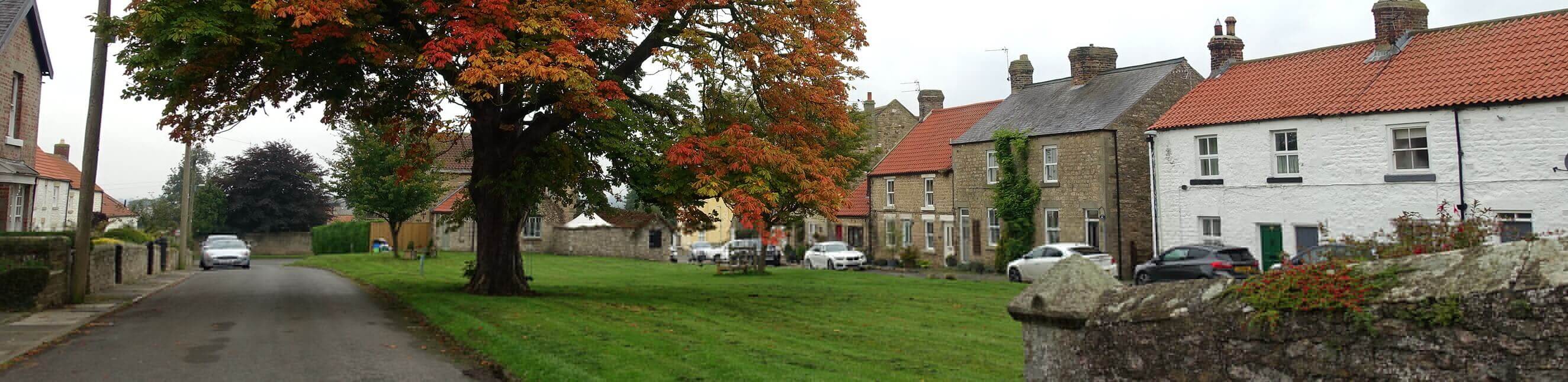
Conservation areas
News
Watch this space for any news about our conservation areas.
What are conservation areas?
Conservation areas are designated heritage assets.
Under section 69(1)(a) of the Planning (Listed Buildings and Conservation Areas) Act 1990, conservation areas are ‘areas of special architectural or historic interest, the character or appearance of which it is desirable to preserve or enhance’ .
Conservation areas are not only defined by the buildings they include. Other elements can also make an important contribution, such as:
- road and footpath networks
- public and private spaces
- boundary treatments (e.g. garden walls)
- features in the public realm (e.g. street furniture)
- ground surfacing
- trees and green spaces
- water and topography
- the wider (landscape) setting
A building or other element contributes to a conservation area by:
- its location, alignment, orientation, size and shape
- its design details including any features, materials, textures and colours
- its use type(s)
- its age
- any alteration(s) it may have experienced over time
- its relationship with surrounding buildings and other elements
- how it is perceived in public views
The following drop-down link provides a brief example analysis:
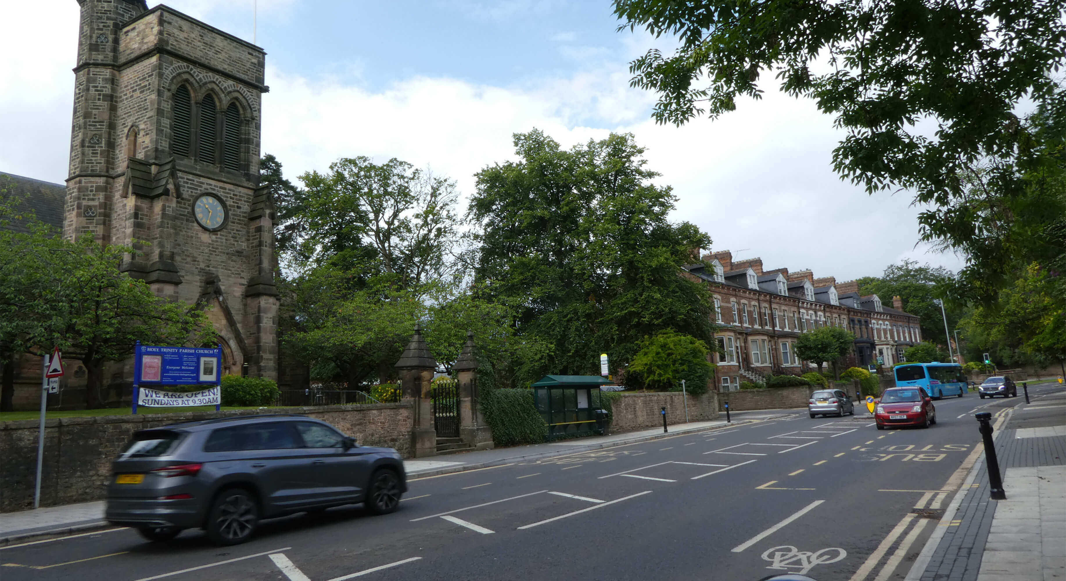
Holy Trinity Church and the terrace are prominent buildings along this historical route inside the West End Conservation Area. The church is built in stone, of more complex shape and in public (religious) use. In contrast, the terrace is of red brick, linear in shape and in private (mainly residential) use.
Despite these differences, the church and terrace harmonise with each other and their surroundings, because:
- the buildings align
- they are parallel yet at a distance to the road
- there is a generous amount of space and vegetation that surrounds them, including mature trees
- both buildings are fronted by stone boundary walls – with the church’s also including ornate stone piers – which provide a ‘buffer’ to the very busy road
Modern street furniture features a bus shelter and painted bollards. These blend in with the character and appearance of the area.
Further information
Planning (Listed Buildings and Conservation Areas) Act 1990 [External link]
Do I live in a conservation area?
There are currently 17 conservation areas in Darlington Borough, see list on the right or below (depending on your device).
You can use this map above to find out whether you live in a conservation area.
All our character appraisals, boundary maps and article 4 directions can be accessed in the following drop-down link:
- Bishopton conservation area map [pdf document]
- Bishopton conservation area character appraisal [pdf document]
- Coatham Mundeville conservation area map [pdf document]
- Coatham Mundeville conservation area character appraisal [pdf document]
- Cockerton village conservation area map [pdf document]
- Cockerton conservation area character appraisal [pdf document]
- Denton conservation area map [pdf document]
- Denton conservation area character appraisal [pdf document]
- Haughton-le-skerne conservation area map [pdf document]
- Haughton-le-skerne conservation area character appraisal [pdf document]
- Heighington conservation area map [pdf document]
- Heighington conservation area character appraisal [pdf document, 5mb]
- High coniscliffe conservation area map [pdf document]
- No appraisal yet
- Hurworth conservation area map [pdf document]
- Hurworth conservation area - original designation [pdf document]
- Middleton one row conservation area map [pdf document]
- Middleton one row conservation area character appraisal [pdf document]
- Northgate conservation area map [pdf document]
- Northgate conservation area character appraisal [pdf document]
- Article 4 direction [pdf document]
- Parkgate conservation area map [pdf document]
- Parkgate conservation area character appraisal [pdf document]
- Piercebridge conservation area map [pdf document]
- Piercebridge conservation area character appraisal [pdf document]
- Sadberge conservation area map [pdf document]
- Sadberge conservation area - original designation [pdf document]
- Sadberge conservation area - boundary extension [pdf document]
- Summerhouse conservation area map [pdf document]
- Summerhouse conservation area - original designation [pdf document]
- Town centre conservation area map [pdf document]
- Town centre conservation area character appraisal [pdf document]
- Town centre end conservation area key map [pdf document]
- Victoria embankment conservation area map [pdf document]
- Victoria embankment conservation area character appraisal [pdf document]
- West end conservation area map [pdf document]
- West end conservation area character appraisal [pdf document]
- West end conservation area key map [pdf document]
List of conservation areas:
- Bishopton CA
- Coatham Mundeville CA
- Cockerton CA
- Denton CA
- Haughton-le-Skerne CA
- Heighington CA
- High Coniscliffe CA
- Hurworth CA
- Middleton One Row CA
- Northgate CA
- Parkgate CA
- Piercebridge CA
- Sadberge CA
- Summerhouse CA
- Town Centre CA
- Victoria Embankment CA
- West End CA
How are conservation areas designated?
Section 69 of the Planning (Listed Buildings and Conservation Areas) Act 1990 requires the Council to identify and designate conservation areas. We also have a legal duty to review our existing conservation area boundaries from time to time.
New designation or reviewal of an existing conservation area is carried out by the Council as follows:
- writing a draft character appraisal
- consulting the public on the draft document
- amending and finalising the appraisal
- adopting the new or amended appraisal
- notification of new or amended boundary
All our adopted appraisals are available from the 'Conservation area documents' drop-down link above.
Further information
Conservation Area Appraisal, Designation and Management. Historic England Advice Note 1 (Second Edition) [external link]
Planning (Listed Buildings and Conservation Areas Act) 1990 [external link]
What effect does designation have?
Conservation areas have additional planning controls:
- The demolition of buildings requires planning permission (s196D, the Town and Country Planning Act 1990)
- Works to a tree require at least six weeks notice to the Council (s211, the Town and Country Planning Act 1990); further information is on our Tree Preservation Orders page
- Permitted development rights are restricted: The Town and Country Planning (General Permitted Development) (England) Order 2015 sets out under schedule 2 which PD rights do not apply to conservation areas ( ‘Article 2(3) land’), meaning that such development will require planning permission
Further permitted development rights can be removed by the Council by imposing Article 4 directions. The Northgate Conservation Area has an Article 4 direction, which can be viewed in the'Conservation area documents'drop-down link above.
In the exercise of planning functions, the Council must pay special attention to the desirability of preserving or enhancing the character or appearance of Darlington's conservation areas (s72, Planning (Listed Buildings and Conservation) Areas Act 1990). 'Exercise of planning functions' means both the formulation of conservation policies for our Local Planand the determination of planning applications.
Because of these additional controls, conservation areas can:
- offer a certain amount of continuity and stability
- introduce conservation-led change
- enhance economic well-being and quality of life
- help communities to regenerate
- add value to a location
Further information
Planning (Listed Buildings and Conservation Areas Act) 1990 [external link]
The Town and Country Planning (General Permitted Development) (England) Order 2015 [external link]
Town and Country Planning Act 1990 [external link]
Do I require planning permission?
The Council does not give advice on whether planning permission is required for any development. We also do not provide free heritage advice.
Information on whether planning permission is required and how to apply can be found in the Planning application and permission sectionof our website. Alternatively, use the Planning Portal website. Or seek professional advice from a third party.
Further information
Planning Portal website [external link]
Conservation areas at risk
Conservation areas can become ‘at risk’ when they are in a poor state of maintenance. Also, modern development and other changes can have a negative impact and put an area 'at risk', for example by:
- removal of historical features (e.g. original windows/doors) and their replacement with unsympathetic products
- demolition of traditional buildings and other elements of interest
- construction of modern structures which are not in keeping with the character and appearance of the area
Historic England’s Heritage at Risk Register currently includes the following Darlington conservation areas:
- Northgate CA
- West End CA
The Council is currently working with Historic England to find ways to take the two conservation areas off the register.
Further information
Heritage at Risk. North East & Yorkshire Register 2023 [external link, pdf document]
This page was last updated in January 2024.